From extremely dry to extremely wet – what a change in just a few months in southern Africa

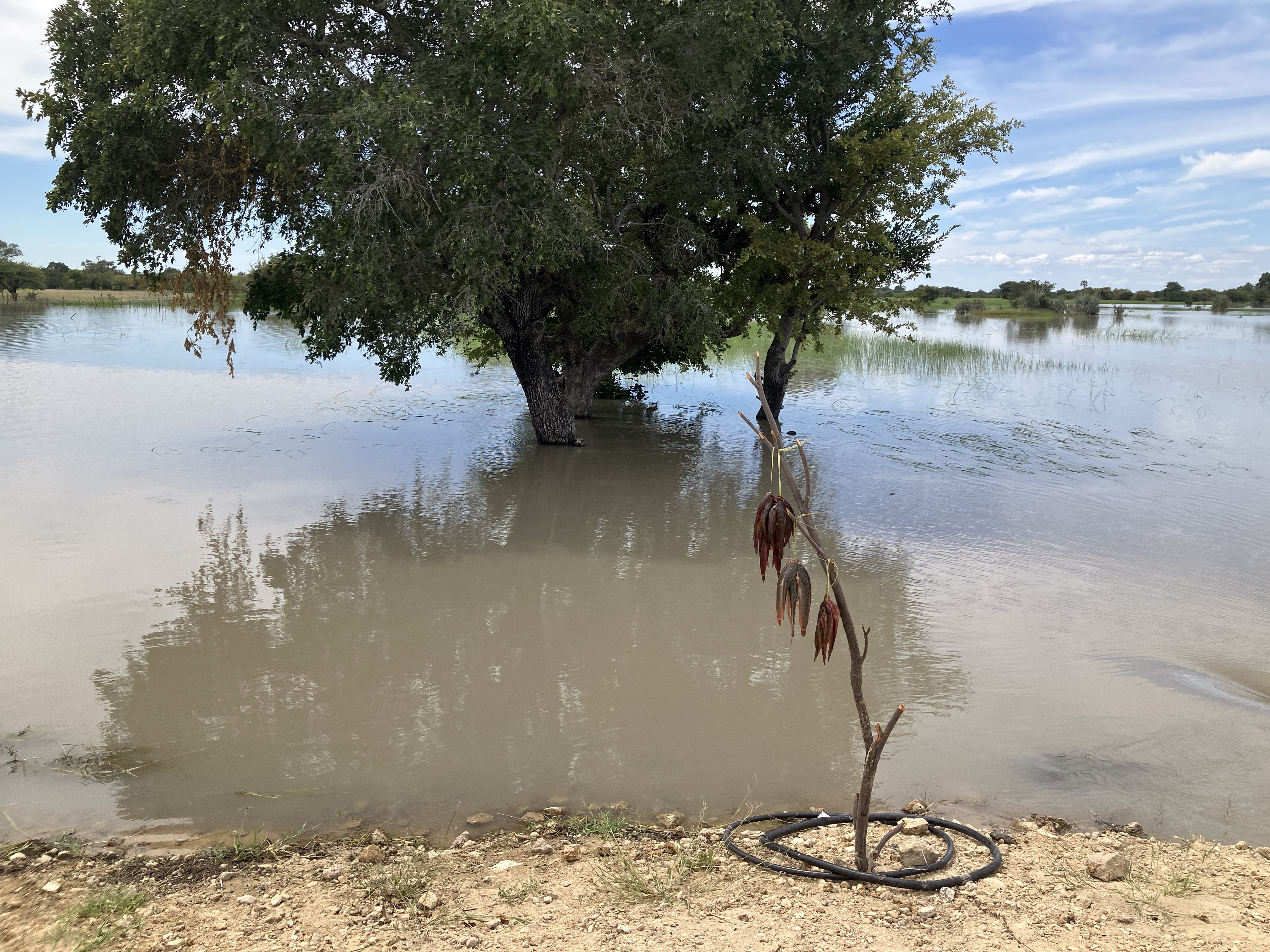
After a record-breaking drought of at least 2 years in the Cuvelai-Cunene catchments in northern Namibia and southern Angola, the 2024/25 rainy season started late around Christmas, but then turned to one of the wettest since 2010/11. This also pertains to most of Namibia such that several dams in the country were filled at 100% capacity and others showed a filling level of around 2/3 or more at the end of the 2024/25 rainy season. This more or less ended the drought situation in the country. Of particular note is the monthly total of 306 mm (401% of the normal) in Windhoek, but also 19 mm at the hyper-arid Walvis Bay station which usually receives a March mean of 1 mm.
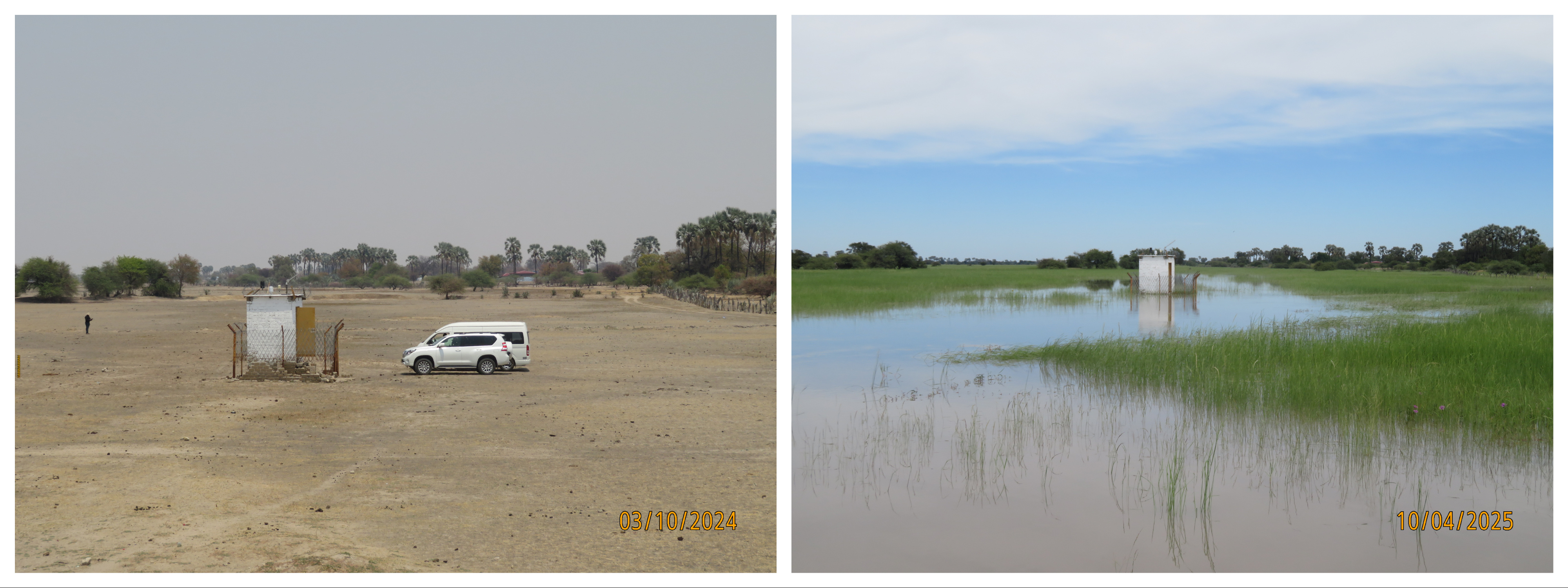
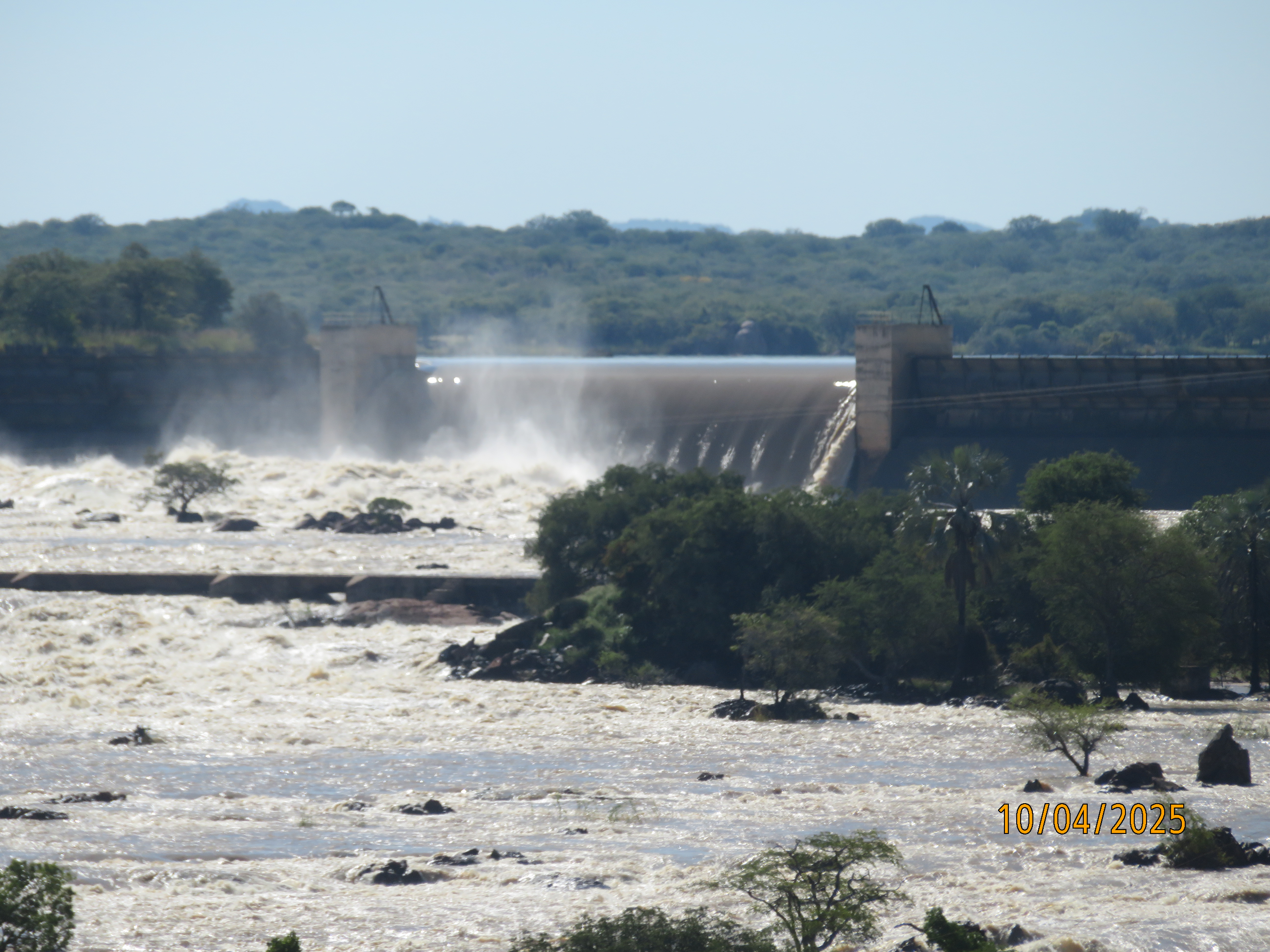
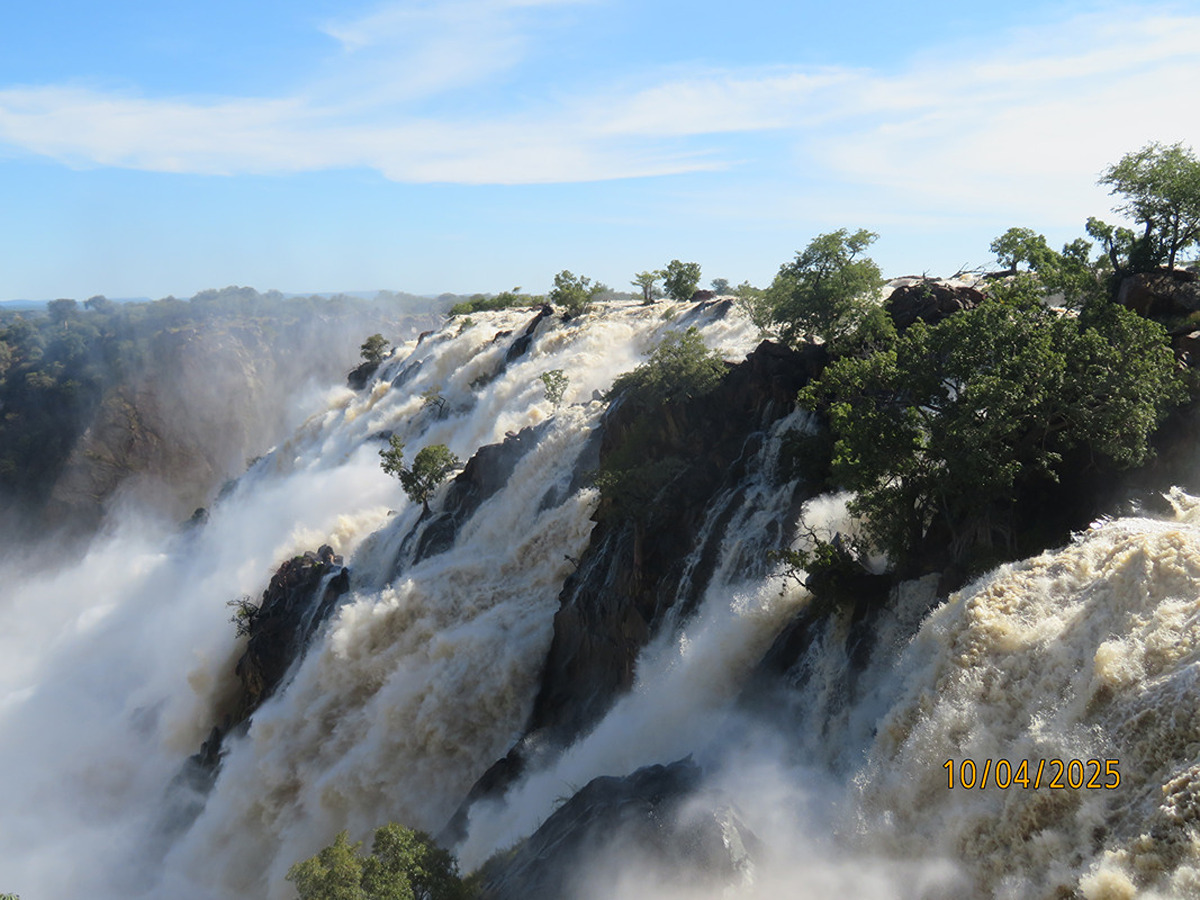
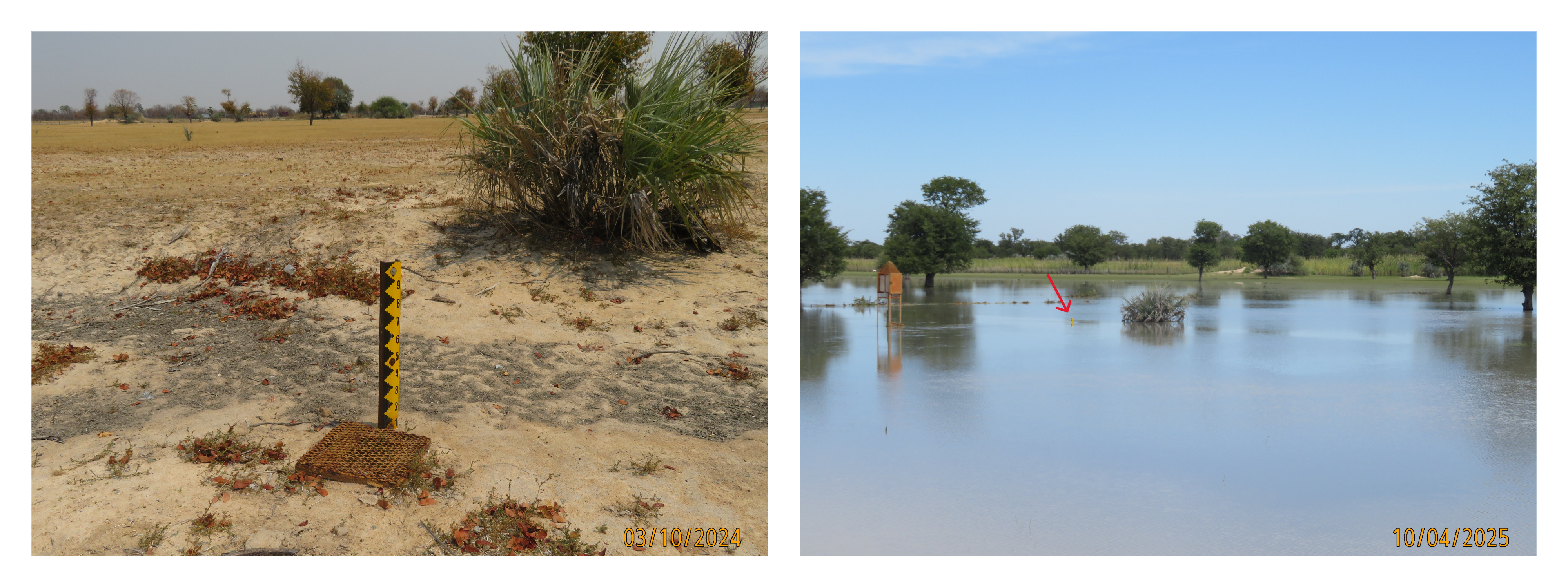
The Co-HYDIM-SA team visited the Cuvelai area in early October 2024, at the peak of the drought situation, and just after the rains in early April. Figures 1 and 2 illustrates the change from a drought-parched landscape to an inundated one. While a few people sadly drowned, the inundated landscape also allowed locals to go fishing (Fig. 3). At the Cunene River, discharge was more than 1600 cbm/s such that the sluice gates at the Ruacana dam were opened (Fig. 4) and the Ruacana falls were as impressive as they were last in 2011 (Fig. 5). Note that the GLOFAS system still predicted the peak flood wave of the Ruacana river to arrive a few days later than 10 April 2025, the day of the visit.
Also, the second transboundary catchment studied by Co-HYDIM-SA was affected by an extreme flooding event; In the Notwane catchment, the city of Gaborone, capital city of Botswana, was affected by an extreme rainfall event on 19 February 2025. It brought more than 100 mm of rainfall at several stations peaking at a value of 160 mm at Mogoditshane Police Station. This happened after already abundant rainfall in the days leading to the event and caused catastrophic flooding in Gaborone. The Gaborone dam went from around 40% to overspilling, causing flood damage downstream.
The wetness of the 2024/2025 can, at least partly, be explained by a La Niña Event in the tropical Pacific. The climatological diagonal cloud band stretching from southern Angola to southern South Africa is displaced southwestwards and more active during La Niña Event. Currently by Co-HYDIM-SA studies to what extent the extreme March 2025 rains in Namibia and the Gaborone extreme event was predictable to assess the early warning potential.